Scan to BIM
BIM projects for redevelopment or refit will usually begin their life cycle with a 3D Laser scan, our expertise enables us to correctly deliver a…
View Service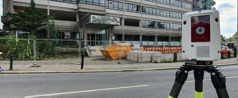
Critical at the pre-planning stage and often commissioned for renovations, conversions, loft or basement extensions. Measured building surveys let Architects, Designers and Developers prepare for renovation or construction.
Measured Building Surveys may help prove an extension/development adheres to local authority standards.

ASES have vast experience from small domestic surveys to large commercial projects. The adoption of Laser Scanning allow ASES surveyors to reduce site times , increase accuracy and the level of detail and reduce risks by capturing data remotely.
A Laser scanned point cloud survey has several other advantages over traditional methods, they eliminate the need for return site visits and offer greater flexibility of data production, ie: 2D or 3D model delivery also allowing additional sections or internal elevations to be extracted from the point cloud at any stage after the survey.
ASES pride themselves in their professional friendly approach offering quick turnaround and attention to detail. We follow the RICS standard of practice.

Surveys can be related to the Ordnance survey Grid, using GPS or Arbitrary Grid, with deliverables in the following formats:
We are ready to talk about your requirements to see how we can help you.
A measured building survey is either a 2D or 3D visual representation of an existing property, structure or site. It is captured using digital surveying techniques and employs the use of a laser scanner or total station to accurately capture the condition, elements and geometry of a building or area.
A measured building survey is required for property redevelopment, including pre-construction planning and design, construction progress monitoring and post-construction asset management. They provide highly accurate information that can be invaluable during any stage of a project's lifecycle.
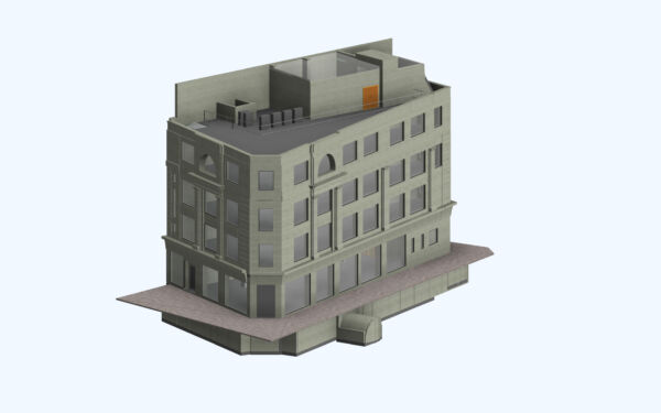
By delivering data in 3D Revit format, it simplifies the process of making changes throughout the entire stages of development due to its ability to accommodate any aspect that may arise during each phase. It can also save time and costs by managing multiple sources into one unified medium that everyone involved in the project can easily access.
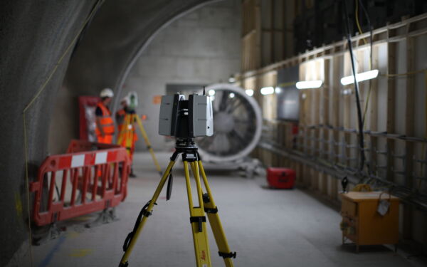
There are two steps in the process, the first being the site or property visit, this is followed by office processing that connects individual scans and produces a 3D point cloud.
Laser scanning is typically carried out by a two-man team, a scanner operator will collect data using a laser scanner which will produce a 3D coordinated point cloud, a surveyor will work alongside the scan operator, creating a grid system and coordinating the scans to the specified control network.
Data is processed off site in the office using a process called Registration, this process aligns and coordinates the scans, once registered, a 3D point cloud is created which allows various outputs, common deliverables are 2D CAD drawings and 3D Revit models.
By implementing the use of the latest laser scanning technology, site times are drastically reduced. A typical residential survey can be completed within 3 hours, with the post processing and the CAD completed off site in our offices.
The survey's duration can vary greatly depending on the size of the space being surveyed and the project's complexity. Additionally, bad weather or other delays may add extra time to the overall length of survey completion. Generally, planning for more rather than less time when scheduling a measured survey is better.
A measured survey cost can vary and is determined on the building size, access, level of detail and whether the building is live or inhabited.
For example, a typical furnished residential property with multiple rooms measuring approx. 100sqm (1000sqft) might require over 100 scans whereas an open plan warehouse space measuring 1000sqm (10,000sqft) may only require a dozen scans.
A survey specification will specify the required level of detail however a typical residential property survey will include, floor plans, external elevations, topographical survey and sections delivered in 2D DWG and PDF formats.
In addition to the above the survey can also include a roof plan (for loft extension purposes), Utility Survey, CCTV Survey
Laser scanning has several benefits, it reduces survey times by rapidly capturing up to 2 million points per second. Re-visits can be eliminated as additional data not specified prior to commissioning the survey can be extracted from the point cloud. For example, property elevations can be drawn in most cases from Topographical survey laser scan data.


BIM projects for redevelopment or refit will usually begin their life cycle with a 3D Laser scan, our expertise enables us to correctly deliver a…
View Service