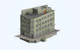
Topographical Surveys
ASES have experience in carrying out accurate cost effective, Topographic Surveys for a wide range of sectors and clients, adapting the level of…
View Service

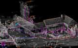
Using Leica Geosystems, RTK, GPS rovers enable instantaneous 3D Geographic positioning, this allows for rapid setting out and surveying.
ASES operate the latest GPS, RTK Rovers, that track both GPS and Glonass Satellites we are able to survey and set out to Ordnance Datum Newlyn by means of the Ordnance Survey Geoid Model (OGSM02).

GNSS equipment has proved invaluable to us in surveying large areas of land and setting out roadworks.
A common use of GPS is in establishing survey control to the Ordnance Survey National Grid, or creating new control where primary stations have been removed.
Combining OS mapping and GPS surveys can assist with boundary issues and legal boundary determination
We are ready to talk about your requirements to see how we can help you.
Get in TouchASES have experience in carrying out accurate cost effective, Topographic Surveys for a wide range of sectors and clients, adapting the level of…
View Service